Showing posts with label pictograph. Show all posts

Wednesday, November 26, 2008

More on petroglyphs/ pictographs

Technically the correct term is pictograph for rock paintings. Petroglyph seems to mean rock carvings, though around here and around the web I hear/ see petroglyph for both most of the time. In googling the words pictograph and Kootenay I did find additional information, including this site, which shows this sketch (click on it to see the whole thing):


With a shock of recognition I realized it was the pictographs we found on Sunday, though we couldn't find a *guide* to tell us what the letters on the sketch represent. But apparently just fifty feet south is another (smaller) set, so apparently we have to go back and find them. The other pictographs mentioned on the above linked page (site 76) are the ones we found last month. I've gone back and added a *pictograph* label to keep these types of posts linked. (Wonder what book I'm writing or could write might have these in it?)

We've suddenly become much more interested in the history of our area. Go figure.

Monday, November 24, 2008

Petroglyphs

A month or so ago we found petroglyphs on a geocaching trip. After that we heard a rumor about another set of them in our valley, so we went hunting them this weekend.

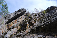
On Saturday we walked along the road where we could see the hillside and plot out possible locations in the right area. There were two sets of bluffs that *might* hold these ancient rock paintings. On Sunday afternoon we headed north on the railway tracks until we came to a cairn. Then we angled down.


We found ourselves on the wrong side of a swamp, but we could just make out the red splotches on the rocks opposite us. See right in the center of the photo? (If you click on the photo, you'll get the big version!) But we couldn't get to them without getting a soaking, and in late November (even a sunny day!) I wasn't keen on that.


So we retraced our steps, found a place we could climb back up to the tracks--STEEP!!!--and followed them through the rock cut and found another trail (fairly easy one) down again on the other side. The ground was a little squoodgy here too, but not under water. We made our way back along the bottom of the cliff, then Jim climbed up to take a few shots. Though I could see the splotches from down below, I couldn't make out the shapes. Jim was calling out, oh, bugs!


Look, there's a dog or a wolf or something!


And a sun...


So of course I had to climb up and have a look for myself! It was a much easier climb than the ones from last month. I was pretty sure I wasn't going to fall and die this time, anyway. (Yeah I'm chicken and afraid of heights. So be it.)


Then it was a long walk back to the truck, and we got home just at dark. But what a cool day!

Monday, October 13, 2008

Geocaching with Jim :)

Today we went for a hike and to find a couple of geocaches. Since Jim got his GPS unit last spring, we've been doing a bit more *tourist in the hometown* stuff. We didn't know these rocks were worth climbing before!


We also didn't know there were petroglyphs in the area. The pile of rock known as Twin Peak One had this one on it:


Here Brody and I are in the *cave* under the glyph:


Then we climbed Twin Peak Two and found this:


If you know me in RL, you know I really DON'T do heights. However, I did climb this rock face to get close enough to see the glyphs. Jim had to haul both Brody and I up! This is the perspective shot: see him standing at the bottom left of the photo? PLEASE be impressed I climbed that rock! You can see the rock drawings on the top right.


We found a safe place on the ledge to wait while Jim got some close-up photos.


Somebody loves it when we get out and explore the countryside around our valley!